Log in
All resources
Create a design
9,296 Free Artworks of Map Collection
bibliothèque nationale de france
eran laor cartographic collection
latin-language maps
english-language maps
maps of spain by tomas lopez
french-language maps of africa
colored engraving on paper
university of texas at arlington
maps by willem and johannes blaeu
italian-language maps
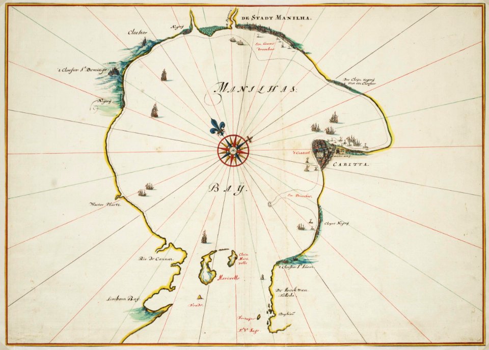
istanbul in the 1780s
maps by tomas lopez
drawings in the museu antônio parreiras
paper and graphite
old maps of the kingdom of naples
lago patria
brazilian paintings in the museu antônio parreiras
firmino monteiro
maps by alexis-hubert jaillot
old maps of toulouse
eran laor cartographic collection
william hughes (geographer)
eran laor cartographic collection
william hughes (geographer)
eran laor cartographic collection
joseph schwarz
eran laor cartographic collection
william henry toms
eran laor cartographic collection
willem blaeu
eran laor cartographic collection
hendrik hondius the younger
eran laor cartographic collection
isaak tirion
eran laor cartographic collection
german renaissance,humanism
eran laor cartographic collection
gerard vandergucht
eran laor cartographic collection
willem blaeu
eran laor cartographic collection
william hughes (geographer)
considérations géographiques et physiques sur les nouvelles découvertes au nord de la grande mer
hokkaido in art
print room of the university of antwerp
kaarten van vlaanderen (prentenkabinet)
maps of paris by braun & hogenberg
maps of paris from paris musées
hôtel de guénégaud (quai de nevers)
collège des quatre-nations
paintings in unidentified private collections
paintings by richard brakenburgh
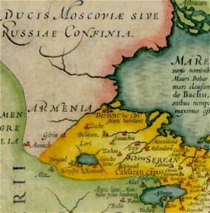
maps of persia by mercator-hondius
details of old maps
flemish prints in the british museum
coenraed lauwers
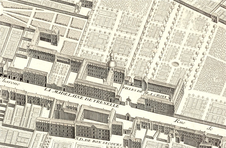
turgot map of paris, david rumsey historical map collection – derivative files
palais de la femme
turgot map of paris, david rumsey historical map collection – derivative files
port de la rapée
portraits by charles-philippe larivière
neoclassicism
the family of frederick, prince of wales (george knapton - windsor castle)
prince edward (great britain) in 1751
eran laor cartographic collection
willem albert bachiene
old maps of salvador (bahia)
jacob van meurs
atlas maior, vol 2 (sweden, russia, poland, eastern europe, and greece) - joan blaeu, 1667 - bl 114.h(star).2
1667 maps of russia
maps in the amsterdam museum
1690s maps of palestine
atlas maior, vol 1 (northern europe, norway, and denmark) - joan blaeu, 1667 - bl 114.h(star).1
1667 maps
eran laor cartographic collection
evert maaskamp
victor levasseur - maps of the world
19th-century maps of martinique
hamburgische elbkarte von melchior lorichs
parts of old maps of hamburg
maps of the course of the rhine by guillaume sanson
guillaume sanson
atlas vingboons
1665
steinfels collection
baroque
maps of the dutch east india company - thailand
old maps of ayutthaya
le neptune francois
charles pène 8th
cartes generales de toutes les parties du monde (1658)
1658 maps of asia
maps by jacques chiquet
1719 maps of africa
17th-century maps of the indian ocean
maps by willem and johannes blaeu
17th-century maps of bourgogne
maps by gerard valck
maps by jacques chiquet
1719 maps of africa
cartes generales de toutes les parties du monde (1658)
maps by guillaume sanson
maps of prague by braun & hogenberg
maps of cheb by braun & hogenberg
maps by willem and johannes blaeu
1640s maps
1744 maps of asia
baroque painting
maps by louis brion de la tour
1761 maps of africa
maps by louis brion de la tour
1761 maps of africa
everett d. graff collection of western americana
george f. cram
eran laor cartographic collection
claes jansz. visscher (ii)
eran laor cartographic collection
guillaume sanson
eran laor cartographic collection
michel van lochom
la virginea pars
secotan
old maps of asturias
1777 maps of spain
old maps of asturias
1777 maps of spain
old maps of the region of murcia
maps of spain by tomas lopez
old maps of asturias
1777 maps of spain
maps of spain by tomas lopez
1768 maps of spain
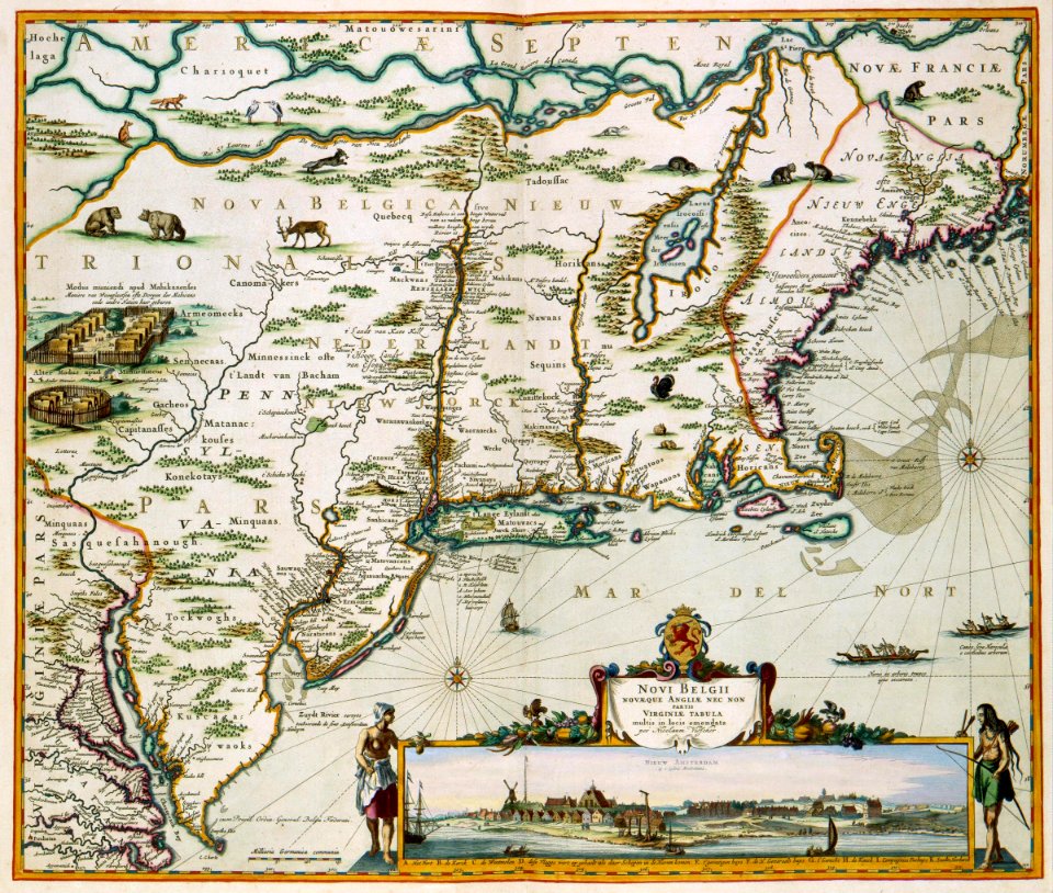
old maps of new england
1684
maps of the west-indische compagnie
1747 maps of africa
paintings by charles c. wood taylor
1830s history paintings
liber qvartvs contrafactur vnd beschreibung von den vornembsten stten der welt (zzk 0.32)
patrimonium 2 (project)
map of the circle of austria by sanson
1700s maps of austria
map of the circle of the rhineland by sanson
1730s maps of rhineland-palatinate
map of the circle of austria by sanson
1700s maps of austria
old maps of the republic of genoa
maps by alexis-hubert jaillot
maps in the library of congress
plaine de grenelle
maps of ports and fortresses of the mediterranean by marco boschini (1651)
old maps of souda (crete)
1640s maps of greece
marco boschini
atlas vingboons
1665
gerardi mercatoris atlantis novi. pars tetria (1638)
17th-century maps of lombardy
19th-century paintings in the metropolitan museum of art
takaku aigai
maps from the mechanical curator collection
balaton albuma (1851) by szerelmey
glaciers and glaciation (1910)
maps of muir glacier
drawings by james mcneill whistler in the metropolitan museum of art
aestheticism
1780 maps of the caribbean
maps by juan lopez
1810s maps of portugal
maps by tomas lopez
18th-century maps of hispaniola
maps by juan lopez
17th-century maps of xaintonge
maps by jodocus hondius
maps by pieter mortier
maps from gallica
maps of besançon by braun & hogenberg
eran laor cartographic collection
eran laor cartographic collection
maps of prague by joris hoefnagel
topographisch-historische ansicht der belagerung kopenhagens (1807)
maps from the mechanical curator collection
maps by willem and johannes blaeu
old maps of gouda
1830s maps of jerusalem
romanticism
1594 maps of baden-württemberg
wilhelm besserer
print room of the university of antwerp
18th-century maps of antwerp
eran laor cartographic collection
giovanni maria cassini
eran laor cartographic collection
giovanni maria cassini
eran laor cartographic collection
francesco lamarra
eran laor cartographic collection
giovanni maria cassini
maps by willem and johannes blaeu
maps of rügen by eilhard lubinus
maps of dunkerque by braun & hogenberg
maps of bourbourg by braun & hogenberg
maps from gallica
baroque
atlas maior, vol 10 (spain and africa) - joan blaeu, 1667 - bl 114.h(star).10
1667 maps
considérations géographiques et physiques sur les nouvelles découvertes au nord de la grande mer
isla de los estados
17th-century maps of amsterdam
maps by nicolaes visscher i
2901 - 3000 of 9,296
Next page
/ 93